

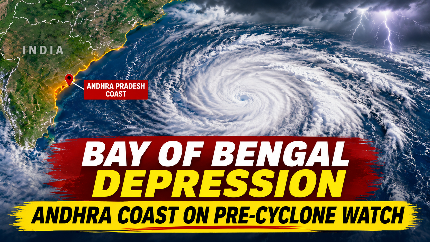
The weather system that is expected to become Cyclone Akvan has grown stronger. On Sunday morning, November 15, the India Meteorological Department (IMD) said the low-pressure area over the southeast Bay of Bengal had turned into a depression, as reported by The Federal. IMD now expects it to become a cyclonic storm by Monday evening and a severe cyclonic storm on November 17, before moving towards the Andhra Pradesh coast.
This would be the third cyclone in the Bay of Bengal in just a few weeks, after Arnab and Murasu.
Where is the system right now?↑
At 8:30 am on Sunday, the depression was about 1,010 km south-southeast of Visakhapatnam and 840 km east-southeast of Chennai. It was moving north at about 10 km/h, with winds of 40 to 50 km/h gusting to 60 km/h, according to IMD figures compiled by Transclew.
Cyclone Akvan: IMD timeline↑
- November 13: Low-pressure area formed over the southeast Bay of Bengal.
- November 14: Became a well-marked low-pressure area.
- November 15 (morning): Turned into a depression.
- November 16: Likely to become a cyclonic storm. It will be named Akvan at this stage.
- November 17: Likely to become a severe cyclonic storm over the west-central Bay of Bengal.
- November 19: May reach very severe cyclonic storm strength, with winds of 120 to 130 km/h gusting to 145 km/h, as per IMD's track forecast.
These timings can change by a few hours as the system develops. IMD will issue fresh bulletins every few hours.
Which areas should be alert?↑
IMD has put the Andhra Pradesh and south Odisha coasts on pre-cyclone watch. This is the first of IMD's four warning stages, and it means the coast could see cyclone conditions in the coming days.
The Regional Meteorological Centre in Chennai has said the storm may grow into a very severe cyclonic storm and move towards the Andhra Pradesh coast, as per DT Next. IMD has not yet given the exact landfall point or time. Officials expect the path to become clearer by Monday.
Rain forecast↑
- Coastal Andhra Pradesh: Heavy to very heavy rain on November 19 and 20. Some places on the north coast may get extremely heavy rain of 21 cm or more.
- Odisha: Heavy rain from November 18. IMD has issued an orange alert for some districts.
- Tamil Nadu: Some heavy rain is possible in parts of the state from November 17, but Chennai is likely to get only isolated light showers.
- Andaman Islands and West Bengal: Heavy rain warnings have also been issued.
Fishermen told to stay ashore↑
Sea conditions are already rough. IMD asked fishermen to return to the coast by November 15 and not to go out to sea until conditions improve, according to Daijiworld. Winds of 45 to 55 km/h, gusting to 65 km/h, are expected over the southwest and central Bay of Bengal between November 15 and 17.
What do "severe" and "very severe" mean?↑
IMD grades cyclones by wind speed:
- Cyclonic storm: 62 to 88 km/h
- Severe cyclonic storm: 89 to 117 km/h
- Very severe cyclonic storm: 118 to 166 km/h
At very severe strength, a storm can uproot trees, damage kutcha houses, bring down power lines and flood low-lying areas.
Why is it called Akvan?↑
The name Akvan was given by Iran. According to Deccan Chronicle, it means "evil mind". Countries around the north Indian Ocean take turns to suggest names, and each one is used only once.
Third storm in a short time↑
Coastal Andhra Pradesh is still recovering from Cyclone Arnab, which crossed the coast in late October, and Cyclone Murasu, which followed in early November. Farmers are worried because another storm now could damage crops that are ready for harvest. Crop damage can also push up vegetable prices, at a time when retail inflation is already high. Read our report on retail inflation crossing 6% in October.
Helpline numbers↑
- 112: All-India emergency number
- 1070: Andhra Pradesh state disaster helpline
- 1800 425 0101: Andhra Pradesh disaster management toll-free number
What you should do↑
- Follow only IMD and your state disaster management authority for updates. Do not trust forwarded messages about landfall.
- Keep a torch, power bank, medicines, drinking water and important documents ready.
- Avoid going near the sea or rivers during heavy rain.
- If you plan to travel by train or road in coastal Andhra Pradesh or Odisha between November 18 and 20, check for cancellations first. Our list of festival special trains may help with return travel.
FAQ
Q1. Has Cyclone Akvan formed? Not yet. A depression formed on November 15. IMD expects it to become Cyclone Akvan by November 16.
Q2. Where will Cyclone Akvan make landfall? IMD has not named a landfall point yet. It says the storm will move towards the Andhra Pradesh coast.
Q3. How strong will Cyclone Akvan get? It may become a very severe cyclonic storm by November 19, with winds of 120 to 130 km/h.
Q4. Which states will get heavy rain? Andhra Pradesh, Odisha, parts of Tamil Nadu, West Bengal and the Andaman Islands.
Q5. Who named Cyclone Akvan? Iran.




0 comments
No comments yet. Comments are read by our team before they appear.